TBSD60
 BSD120
 BSD98
BSD98 BSD70
BSD70 BSD60
BSD60 BSD50
BSD50 BSD217
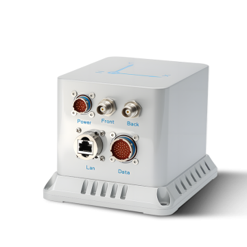
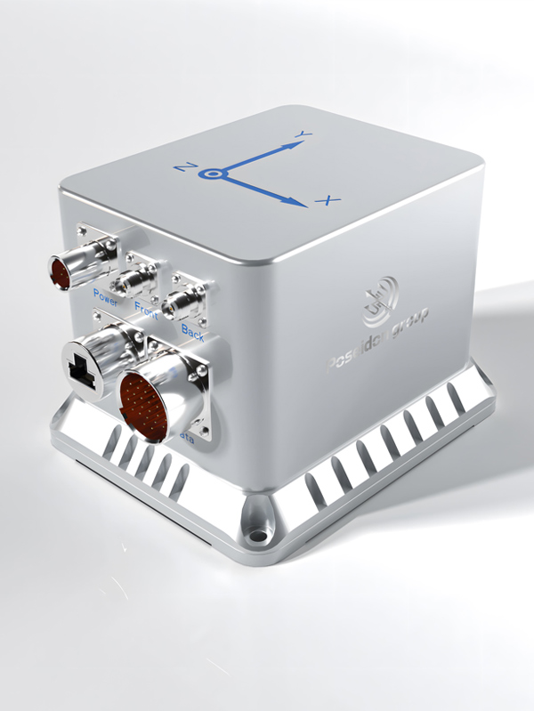
 INS1700
 INS970
 INS570
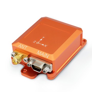
 INS170
 SLA-4B1L1-65
 SLA-4B1L1-130
 SLA-8B1L1-165
 DIVER 101
 DIVER 102
 DIVER 103
 DIVER 104
 DIVER 105
 DIVER 106
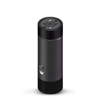
 SLLR3000
 SLLR905
 SLLD25
 160M
160M 170M
170M SLFC-70
 SLAF280
 MR360
MR360
Leave Your Message
In the realm of marine surveying and underwater robotics, navigating the subsea environment presents one of the most formidable engineering challenges: the complete attenuation of Radio Frequency (RF) signals. Traditional Global Navigation Satellite Systems (GNSS) are rendered entirely ineffective just a few meters below the water's surface. This creates an absolute "GPS-denied" zone where Subsea Remotely Operated Vehicles (ROVs) and Autonomous Underwater Vehicles (AUVs) must rely on advanced Inertial Navigation Systems (INS) combined with acoustic aiding to maintain spatial awareness, execute precise maneuvers, and gather georeferenced data.
The integration of a high-precision GNSS INS System at the surface vessel, seamlessly coupled with subsea inertial sensors and acoustic positioning (like USBL or LBL), forms the backbone of modern offshore operations. By utilizing cutting-edge Fiber Optic Gyroscopes (FOG) or tactical-grade Micro Electro Mechanical Systems (MEMS), our systems calculate position, velocity, and attitude (heading, pitch, and roll) with unparalleled accuracy, bridging the gap between surface coordinates and deep-sea operations.
The global demand for subsea INS has surged, driven by offshore wind farm installations, deep-sea mining exploration, and underwater infrastructure maintenance. Industries are shifting from heavy, expensive legacy systems to compact, AI-calibrated MEMS and FOG solutions that reduce operational costs of survey vessels by optimizing mission time.
To combat the natural drift of inertial sensors over time, modern Marine INS units are tightly coupled with Doppler Velocity Logs (DVL) and Ultra-Short Baseline (USBL) acoustic systems. This sensor fusion, managed by advanced Kalman filtering algorithms, ensures sub-metric accuracy even during prolonged deep-water deployments.
The deployment of robust GNSS INS technology fundamentally transforms how marine professionals interact with the underwater world. Below are the core industrial applications where our precision navigation technology is indispensable.
High-resolution seabed mapping requires the synchronization of Multibeam Echosounders (MBES) with precise attitude and heading data. Even a fraction of a degree of roll or pitch error can translate to massive depth inaccuracies in deep water. Our INS systems provide real-time heave, pitch, and roll compensation, ensuring that hydrographic surveys meet stringent IHO (International Hydrographic Organization) standards. This is vital for charting safe navigational routes and identifying geological hazards.
Subsea pipelines, wellheads, and risers require continuous monitoring for structural integrity and leak detection. Work-class ROVs deployed for these tasks operate in complex, cluttered acoustic environments where multipath interference can disrupt traditional acoustic positioning. A highly stable INS allows the ROV to maintain a steady course and precise station-keeping via dead reckoning, enabling robotic manipulators to perform delicate maintenance tasks seamlessly.
The exponential growth of offshore wind farms necessitates massive networks of subsea power cables. Trenching ROVs and cable-laying vessels rely on integrated GNSS/INS systems to ensure cables are laid precisely along predefined corridors, avoiding rocky outcrops or existing infrastructure. Accurate positioning prevents cable tension issues and ensures long-term operational viability of the renewable energy grid.
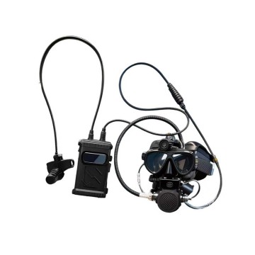
In emergency salvage operations or archaeological excavations, time and precision are critical. ROVs equipped with our tracking and locating systems (like the DIVER series) can rapidly map debris fields in zero-visibility conditions. The INS provides the spatial framework required to stitch together sonar images, creating accurate 3D models of the wreckage and guiding recovery tools with pinpoint accuracy.
The future of marine surveying and ROV operations is being shaped by Artificial Intelligence and Edge Computing. Traditional Kalman filters are being augmented with AI-driven error modeling, which learns the specific vibration profiles of the ROV thrusters and dynamically compensates for them in real-time. Furthermore, the trend toward miniaturization is making tactical-grade MEMS technology viable for smaller, man-portable micro-ROVs, democratizing high-precision oceanographic research.
Another significant trend is the development of Swarm AUVs. Instead of deploying a single, massive survey vehicle, operators are deploying fleets of smaller, interconnected AUVs. These swarms require sophisticated underwater acoustic communication systems (like our DIVER 102) combined with synchronized INS to share relative positioning data, enabling massive areas of the seabed to be mapped simultaneously in a fraction of the time.
Based in Hong Kong, we are a global enterprise dedicated to delivering high-quality products and professional services. We have established long-term, stable, and efficient partnerships with numerous suppliers worldwide, ensuring competitive pricing and superior product quality.

Reducing costs by 25%
Improving performance by 20%

Ensuring stable quality and efficiency
Delivering cross-industry solutions from components to full systems
Poseidon International Limited, Hong Kong strives to provide satisfactory products and services to customers from all walks of life.

We provide comprehensive, all-in-one solutions, whether for components, products, systems, or complete project solutions, always ensuring the best value for our clients.

Our experienced team, with deep expertise in international trade, is dedicated to crafting cost-effective solutions tailored to customer needs.

Additionally, through close partnerships with leading logistics providers, we guarantee timely and secure deliveries.

We specialize in the independent research, design, and production of fiber optic gyroscopes (FOG), inertial navigation systems (INS), attitude and control systems, autonomous driving systems, and intelligent control systems for unmanned equipment. By integrating industry-specific requirements, we have made significant technological advancements in digitalization, automation, and intelligence, securing multiple technical patents. With years of experience, we have evolved into a multi-industry intelligent solutions provider with a portfolio of proprietary core technologies.
Our core team comprises seasoned experts with extensive backgrounds in aerospace and inertial navigation. We have successfully tackled critical technological challenges in high-precision GNSS-free navigation, laser measurement, integrated navigation, multi-source data fusion, and precise positioning—areas that were once bottlenecks in the industry.


Our products are smaller in size, higher in accuracy, and more stable in performance, featuring long-term dynamic auto-calibration with zero-drift operation. They are widely adopted in scientific research, industrial control, intelligent unmanned systems, high-precision detection, and metrology. Having passed rigorous validation in aviation, aerospace, marine, mining, and railway applications, our solutions have been procured in bulk, filling key technological gaps in China.

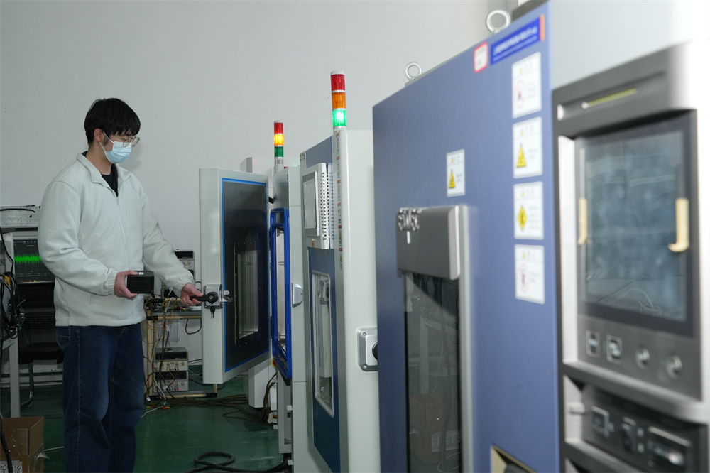
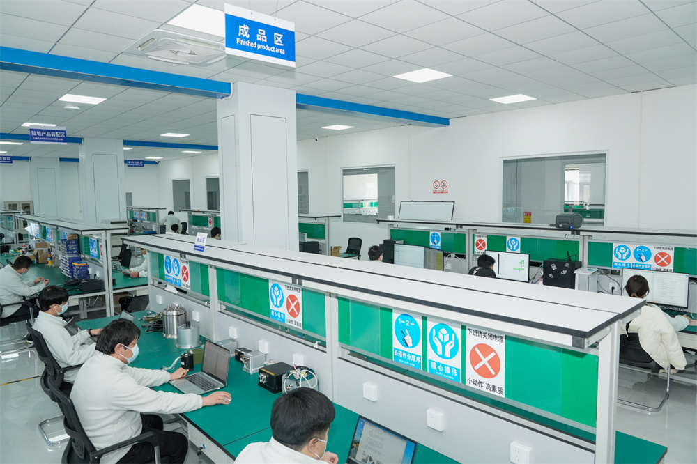
We operate over 6,000-square-meter manufacturing facility in mainland China, equipped with advanced R&D, production, and testing infrastructure, enabling large-scale production and timely delivery. Our network of subsidiaries, offices, and spare parts warehouses across China ensures prompt technical support and after-sales service.
Compared to similar companies, we offer unique advantages:

Creating mutually beneficial relationships with clients and partners.

Commitment to ethical business practices.

Providing clear, one-time offers with no hidden costs.

24/7 service guarantee in all time zones with minimal response time.
"Guided by the vision of 'Connecting the World through Inertial Navigation', we strive to push the boundaries of navigation technology, aiming to become a leading integrated solutions provider with a broad product portfolio and advanced competencies."
Contact Us!