Lately, there's been quite a push for super accurate navigation, which has really driven some pretty exciting advances in Gnss Ins Systems. If you look at what ResearchAndMarkets reports, the global GNSS market is projected to hit around $251 billion by 2025 — no small feat, right? This huge growth just underlines how vital pinpoint positioning has become in sectors like auto tech and aviation.
So, basically, a GNSS INS system combines signals from satellites with data from inertial sensors. When these two work together, they make our positional info way more accurate and reliable. Companies like Trimble and Leica Geosystems are already using this tech to step up their game in surveying and mapping. But, of course, it’s not all smooth sailing; there are still hurdles, especially in places like city canyons where tall buildings can block satellite signals.
And as these GNSS INS systems keep improving, things get a little more complex. The way hardware and software interact can sometimes cause inaccuracies if they’re not calibrated just right. Fixing those issues is pretty crucial if we want this tech to really reach its full potential. Understanding how these systems work behind the scenes will definitely be key as we move forward in this space.

What is a GNSS INS System?
A GNSS INS system combines Global Navigation Satellite System (GNSS) with Inertial Navigation System (INS). This integration enhances navigation accuracy. GNSS provides position and time, while INS tracks movement using sensors. Together, they create a reliable navigation solution.
Currently, the market for GNSS INS systems is rapidly growing. According to a recent industry report, the GNSS market is projected to reach $238 billion by 2025. This growth reflects the increasing demand for precise location data across various sectors, including autonomous vehicles and aviation.
Accuracy remains a challenge. GNSS signals can be disrupted by buildings or atmospheric conditions. INS can drift over time, leading to possible errors. This system works best when both technologies compensate for each other’s weaknesses. Continuous improvements are essential to developing robust algorithms and sensors, making GNSS INS systems more accurate and reliable in real-world scenarios.
Key Components of a GNSS INS System
A GNSS INS system amalgamates Global Navigation Satellite System (GNSS) data with Inertial Navigation System (INS) information. This combination improves position accuracy and reliability. The key components of such a system include GNSS receivers, inertial sensors, and computation units.
GNSS receivers capture satellite signals. These signals help determine the precise location on Earth. However, signals can sometimes be weak or obstructed by buildings or trees. This is where inertial sensors come into play. They measure movement and orientation. Accelerometers detect changes in speed, while gyroscopes track rotational motion. Together, they create a continuous flow of positional data, even when GNSS signals are unavailable.
The computational unit processes data from both systems. It merges information to provide real-time updates. This integration can be complex and may sometimes yield inaccuracies. Noise from sensors or timing discrepancies could lead to errors. Careful calibration is essential. Engineers often revisit system performance to improve reliability under various conditions. By comprehending these components, users can better appreciate the capabilities and limitations of GNSS INS systems.
How GNSS and INS Complement Each Other
GNSS (Global Navigation Satellite System) and INS (Inertial Navigation System) work together to enhance positioning accuracy. GNSS relies on signals from satellites. It provides location data worldwide. However, GNSS is vulnerable to conditions like urban canyons and dense forests. Signals can be blocked or reflected, leading to errors. In contrast, INS offers a self-contained solution. It uses accelerometers and gyroscopes to track position and orientation changes.
Reports indicate that combining GNSS and INS reduces errors significantly. For instance, the accuracy can improve by up to 50% in challenging environments. This enhanced performance is crucial for applications such as autonomous vehicles and drones. The GNSS provides periodic updates, while INS fills in gaps during satellite signal loss.
Despite advancements, challenges remain. Integration can be complex. The systems must be calibrated to work seamlessly. Also, the reliance on GNSS means it can still fail in critical scenarios. The future lies in enhancing these integrations. More robust algorithms and sensors may help address existing weaknesses. The quest for perfect positioning continues.
The Working Principle of GNSS INS Systems
The working principle of GNSS INS systems involves integrating two key technologies: Global Navigation Satellite System (GNSS) and Inertial Navigation System (INS). GNSS uses satellites to provide position and timing data, while INS utilizes accelerometers and gyroscopes to track movement. Both systems have their strengths and weaknesses, which is why they are combined.
When combined, Gnss And Ins enhance positional accuracy. GNSS may struggle in urban canyons or dense forests. During these times, the INS takes over. It can estimate the position based on initial conditions until GNSS can reestablish a reliable signal. This dynamic allows for continuous navigation, even in challenging environments.
However, challenges still exist. The INS can drift over time, leading to inaccuracies. If not carefully calibrated, the output may be misleading. Users must regularly update the system for optimal performance. A balance between GNSS and INS is critical for improved precision and reliability in navigation tasks.
Applications of GNSS INS Technology
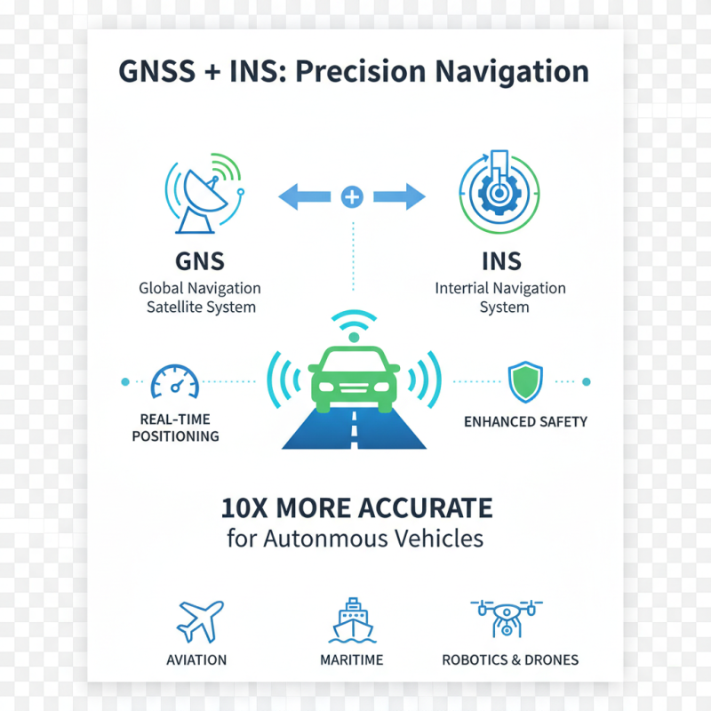
GNSS INS technology has diverse applications across various sectors. In the transportation industry, it plays a vital role in navigation systems. These systems utilize Global Navigation Satellite Systems (GNSS) along with Inertial Navigation Systems (INS) to provide precise location data. According to recent industry reports, integration improves accuracy by up to 10 times compared to GNSS alone. This accuracy is crucial for autonomous vehicles, where safety depends on real-time positioning.
In agriculture, GNSS INS systems optimize resource management. Farmers use these technologies for precision farming, enhancing yield while minimizing waste. Reports suggest that using these systems can increase crop yields by 15-20%. This innovation helps in mapping fields and tracking equipment, making farming more efficient and sustainable. However, challenges remain. Not all regions have reliable GNSS signals, which can lead to inconsistent performance.
Additionally, maritime operations benefit significantly from this technology. Ships equipped with GNSS INS can navigate challenging waters more effectively. They can help avoid hazards and improve route planning. Yet, the interplay of GNSS and INS requires continuous fine-tuning. The effectiveness of Gnss Vs Ins varies depending on environmental conditions. Each application reveals room for improvement in both accuracy and reliability.
Advantages of Using GNSS INS Systems
GNSS INS systems combine Global Navigation Satellite System (GNSS) and Inertial Navigation System (INS) technologies. This combination enhances the accuracy of positioning and navigation data. One major advantage is improved reliability in various environments. GNSS signals can struggle in urban canyons or dense forests, but INS can maintain accuracy without direct satellite signals.
The integration of these systems offers robust solutions for dynamic applications. For instance, in autonomous vehicles, Gnss Ins Solutions ensure precise positioning even when satellite visibility is poor. Users can experience minimal downtime and consistent performance. Additionally, this technology provides real-time data which is crucial for decision-making in challenging situations.
One possible drawback is the cost of high-quality GNSS INS systems. Not all users may find them affordable. Maintenance can also be complex. Striking a balance between performance and cost is important. Investing in such advanced systems requires careful consideration. The potential for enhanced safety and efficiency must be weighed against these factors.
Challenges and Limitations of GNSS INS Systems
GNSS INS systems combine Global Navigation Satellite System (GNSS) data with Inertial Navigation Systems (INS) for enhanced positioning accuracy. However, they face significant challenges. Signal reception can be obstructed by buildings or natural formations. This limits the system's effectiveness in urban canyons or densely wooded areas. According to a recent industry report, accuracy can drop to within five meters under such conditions, which does not meet many operational standards.
Sensor drift is another concern. INS components can accumulate errors over time, especially in prolonged missions. The integration of software post-process GNSS INS can help correct these errors, but it introduces complexity into the workflow. The need for precise calibration is critical. It demands skilled operators familiar with the intricacies of both GNSS and INS technologies.
Tip: Regularly evaluate the operational environment. Understanding potential interference can improve performance. In cases where accuracy is inconsistent, consider using additional reference points for validation. Be aware that while GNSS INS systems offer many benefits, their limitations must be acknowledged. Having contingency plans can mitigate impacts when technology doesn’t perform as expected.
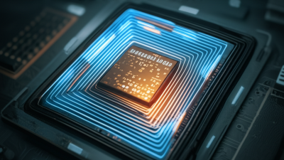
Leveraging MEMS Technology: Insights from the 2023 Market Analysis Report on Micro Electro Mechanical System 170M Applications
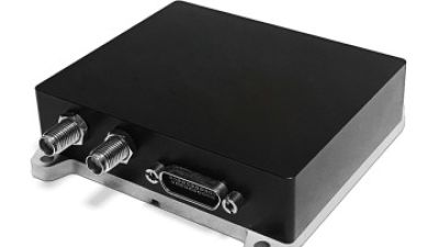
The 2023 Market Analysis Report on Micro Electro Mechanical Systems (MEMS) reveals significant advancements in MEMS technology, particularly in its applications within navigation systems. As industries demand more precise and compact solutions, MEMS devices are rapidly becoming the go-to choice for high-performance navigation. With a heading accuracy of 0.1° and attitude accuracy also at 0.1°, these systems demonstrate exceptional reliability and precision, crucial for applications ranging from aerospace to robotics.
One of the standout features of contemporary MEMS navigation products is their extremely small and lightweight design. This miniaturization not only enhances portability but also allows for integration into a wider array of devices, including drones, smartphones, and wearable tech. The convergence of high performance and compact size opens up new possibilities for innovation and efficiency, making MEMS technology integral to the future of navigation and positioning services. As industries leverage these advancements, the value of MEMS systems continues to grow, solidifying their role in shaping the next generation of smart devices and applications.
FAQS
: The purpose is to provide helpful information on various topics.
Yes, there are multiple articles discussing health. They summarize key points effectively.
Yes, detailed insights on nutrition are available. They focus on balanced diets and essential vitamins.
Sources are referenced, but always cross-check with trusted platforms. Personal reflection is encouraged.
Yes, there are practical tips for stress management. Simple strategies include breathing exercises and time management.
Conflicting information is common. It’s important to evaluate and reflect on various viewpoints.
Many sections target beginners. However, some concepts may require deeper understanding. Take your time to digest.
Yes, examples are used to illustrate key concepts. They can help in visualizing information.
It's better to consult experts for personal situations. Reflection on your own experiences is valuable.
Updates happen periodically, but not always in real-time. Stay curious and seek new information regularly.
Conclusion
A GNSS INS System, or Global Navigation Satellite System Inertial Navigation System, integrates satellite navigation and inertial measurement technologies to provide accurate positioning and navigation data. The key components include GNSS receivers, inertial sensors, and a processing unit that combines data from both sources. This system effectively addresses the limitations of each technology; while GNSS provides precise location data, INS offers continuous tracking in environments where satellite signals may be obstructed.
The working principle of GNSS INS Systems relies on the continual integration of GNSS signals with inertial data, allowing for high accuracy in various applications, from aviation to autonomous vehicles. Despite the advantages, such as enhanced reliability and robustness, challenges like sensor drift and susceptibility to interference must be managed. Overall, the GNSS INS System represents a significant advancement in navigation technology, combining the strengths of both GNSS and INS to meet diverse navigation needs.
 TBSD60
 BSD120
 BSD98
BSD98 BSD70
BSD70 BSD60
BSD60 BSD50
BSD50 BSD217
 INS1700
 INS970
 INS570
 INS170
 SLA-4B1L1-65
 SLA-4B1L1-130
 SLA-8B1L1-165
 DIVER 101
 DIVER 102
 DIVER 103
 DIVER 104
 DIVER 105
 DIVER 106
 SLLR3000
 SLLR905
 SLLD25
 160M
160M 170M
170M SLFC-70
 SLAF280
 MR360
MR360