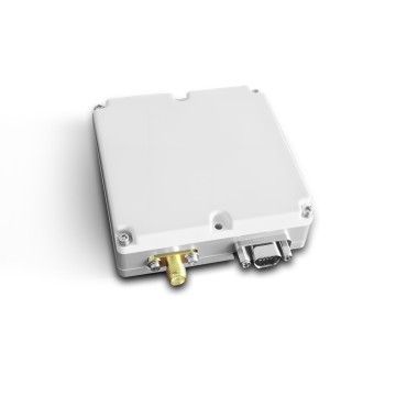
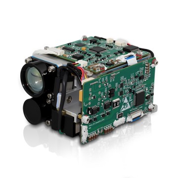
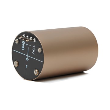
 TBSD60
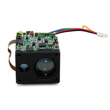
 BSD120
 BSD98
BSD98 BSD70
BSD70 BSD60
BSD60 BSD50
BSD50 BSD217
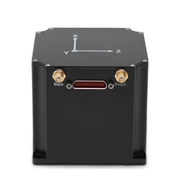
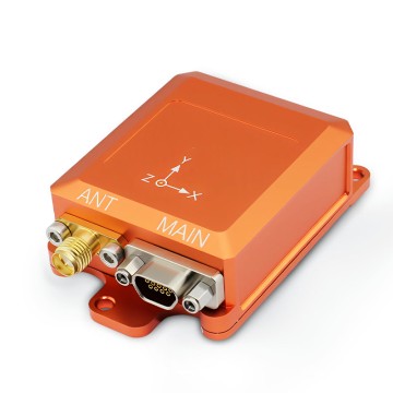
 INS1700
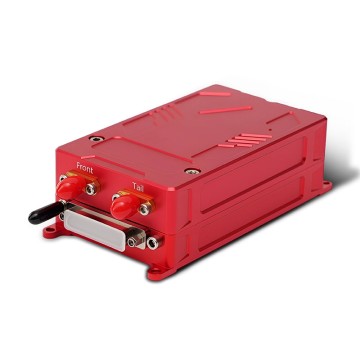
 INS970
 INS570
 INS170
 SLA-4B1L1-65
 SLA-4B1L1-130
 SLA-8B1L1-165
 DIVER 101
 DIVER 102
 DIVER 103
 DIVER 104
 DIVER 105
 DIVER 106
 SLLR3000
 SLLR905
 SLLD25
 160M
160M 170M
170M SLFC-70
 SLAF280
 MR360
MR360


Wholesale Geo Survey Component: Top Suppliers & Factories for Quality
As a leading provider of Geo Survey Components, we understand the unique needs of OEMs, suppliers, and factories in today’s competitive market. Our cutting-edge components are designed to enhance your geo-surveying capabilities, ensuring accurate and reliable data collection for a wide range of applications. I can assure you that the quality of our products meets international standards, making them ideal for your projects, We take pride in our ability to deliver customized solutions tailored to your specifications. Whether you're sourcing for large-scale operations or specialized tasks, our team at Poseidon International Group (Hong Kong) Limited is committed to providing exceptional service and support. We believe in building strong partnerships and understanding your specific requirements, so there's always an opportunity to collaborate, Choose us as your trusted partner in geo-surveying components, and let's elevate your operational efficiency together


How To Decide Between Geo Survey Component Your End-to-End Solution Products
Deciding between a Geo Survey Component and an End-to-End Solution can be a critical choice for procurement professionals in various industries. Geo Survey Components, specialized tools for mapping and geospatial analysis, offer precision and targeted functionality. However, their implementation often requires additional integration with other systems, which can lead to increased complexity and potential for errors.
On the other hand, an End-to-End Solution encompasses a holistic approach, integrating all necessary components into a seamless workflow. This not only simplifies operations but also ensures compatibility and reduced risk of failure at various stages. For buyers, an End-to-End Solution might present a better investment, offering comprehensive support and the opportunity to leverage advanced technologies such as fiber optic gyroscopes and inertial navigation systems, which can lead to enhanced performance and reliability in critical applications.
Ultimately, the choice hinges on specific project requirements, budget constraints, and long-term operational goals. It is essential to evaluate the scale of the project, existing infrastructure, and future scalability when making this decision. Engaging with suppliers who hold expertise in both components and comprehensive systems can provide valuable insights, enabling informed decisions to optimize operational efficiency and achieve greater success in the field.
How To Decide Between Geo Survey Component Your End-to-End Solution Products
| Survey Component | Type | Accuracy (%) | Cost ($) | Deployment Time (days) | Ideal Use Case |
|---|---|---|---|---|---|
| LiDAR Survey | Remote Sensing | 95 | 1500 | 10 | Topographic Mapping |
| Ground Penetrating Radar | Geophysical | 90 | 2000 | 15 | Utility Location |
| Magnetometry | Geophysical | 85 | 1200 | 10 | Site Investigation |
| Seismic Survey | Geophysical | 92 | 2500 | 20 | Subsurface Analysis |
| 3D Geomapping | Remote Sensing | 88 | 1800 | 12 | Urban Planning |
Excellence in Geo Survey Component Pioneers in the Field Exceeds Industry Benchmarks


L
Lucas Green
What a great experience! The product has great quality, and the service team was very professional.
04
July
2025
A
Abigail Smith
Exceeding expectations in quality and service. Very professional staff!
04
June
2025
J
Jack Reed
Amazing quality! The support staff was knowledgeable and friendly.
21
May
2025
A
Anna White
Fantastic durability! The customer service representatives were highly professional.
06
June
2025
J
James Carter
Wonderful craftsmanship! Their after-sales team was attentive and knowledgeable.
27
May
2025
E
Ella Mitchell
Excellent item! Their customer support team went above and beyond.
03
June
2025